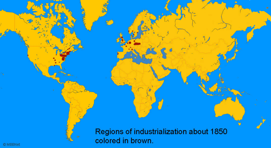

Regions colored in brown represent established and emerging regions of industrialization about 1850.
References
Map is a Mercator projection that exaggerates the size of areas far from the equator.
Maps created with GMT software
William Hoffman - hoffm003@umn.edu